Aerial Map of Wheaton College
This is a collaborative project with European Makers using multirotor Unmanned Aerial Vehicles with high resolution cameras to collect aerial photos, stitch them into stereographic panoramas, and host them on the krpano viewing engine. The project, Okolo, is still in its early alpha stages.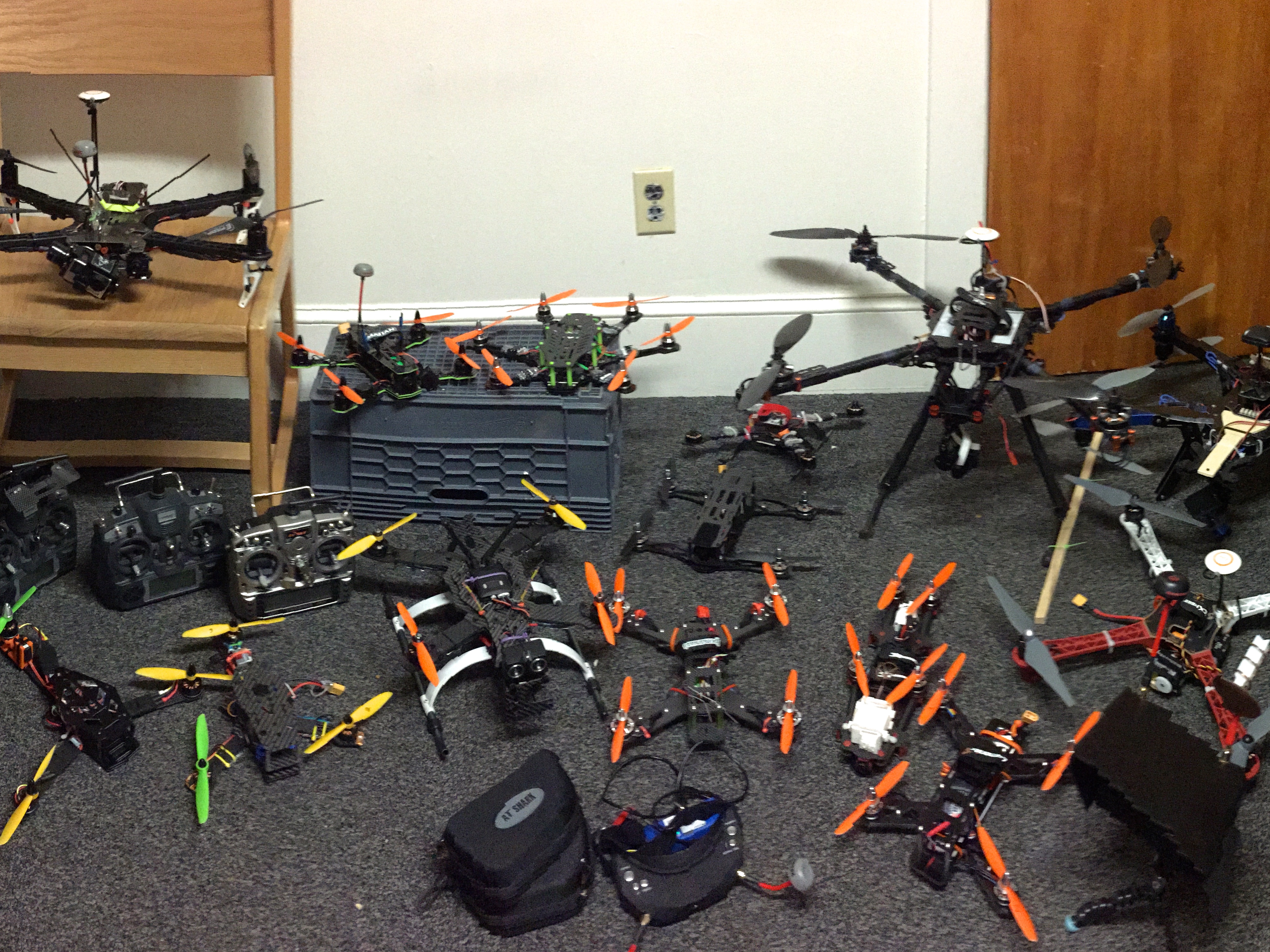
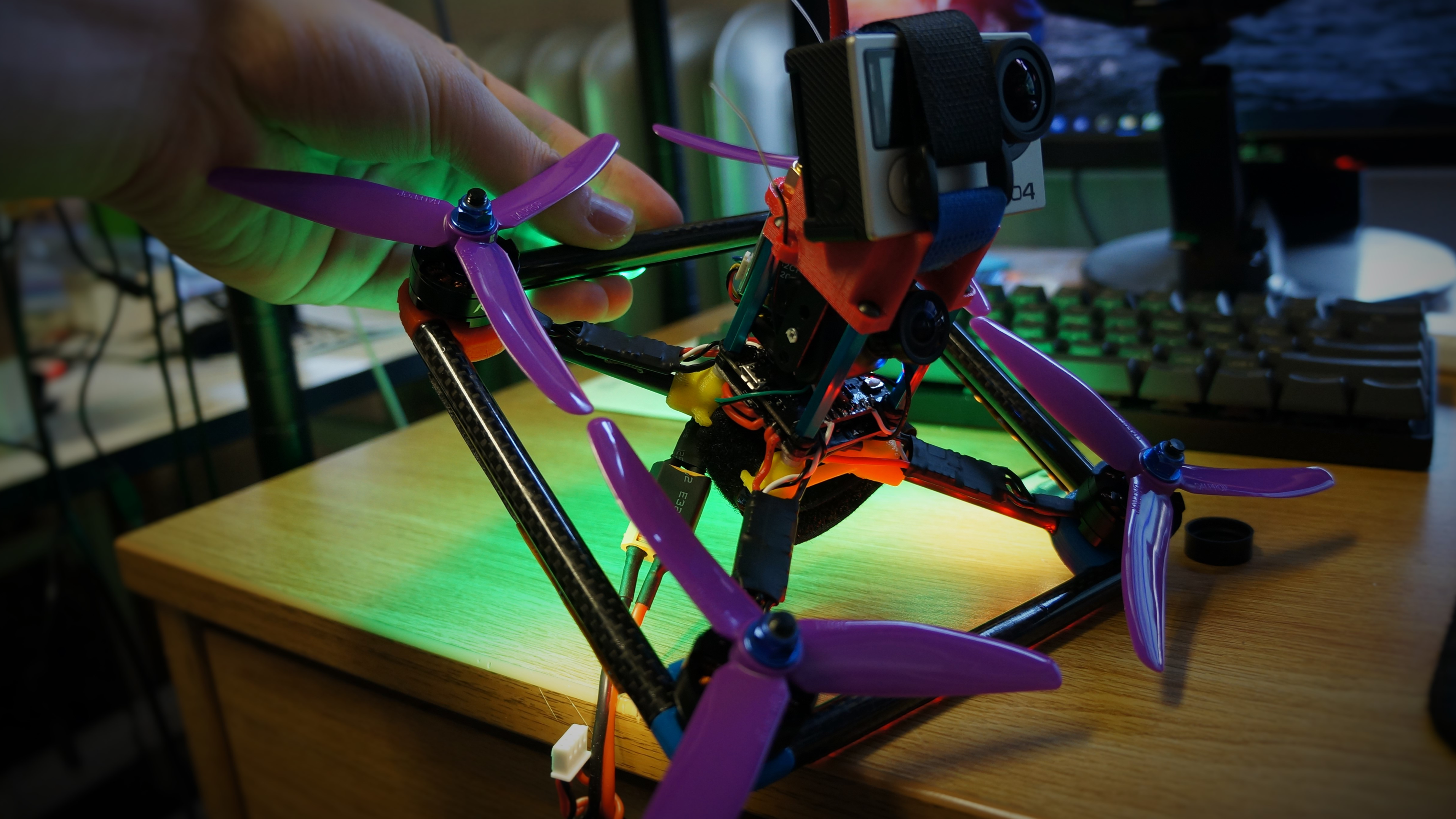
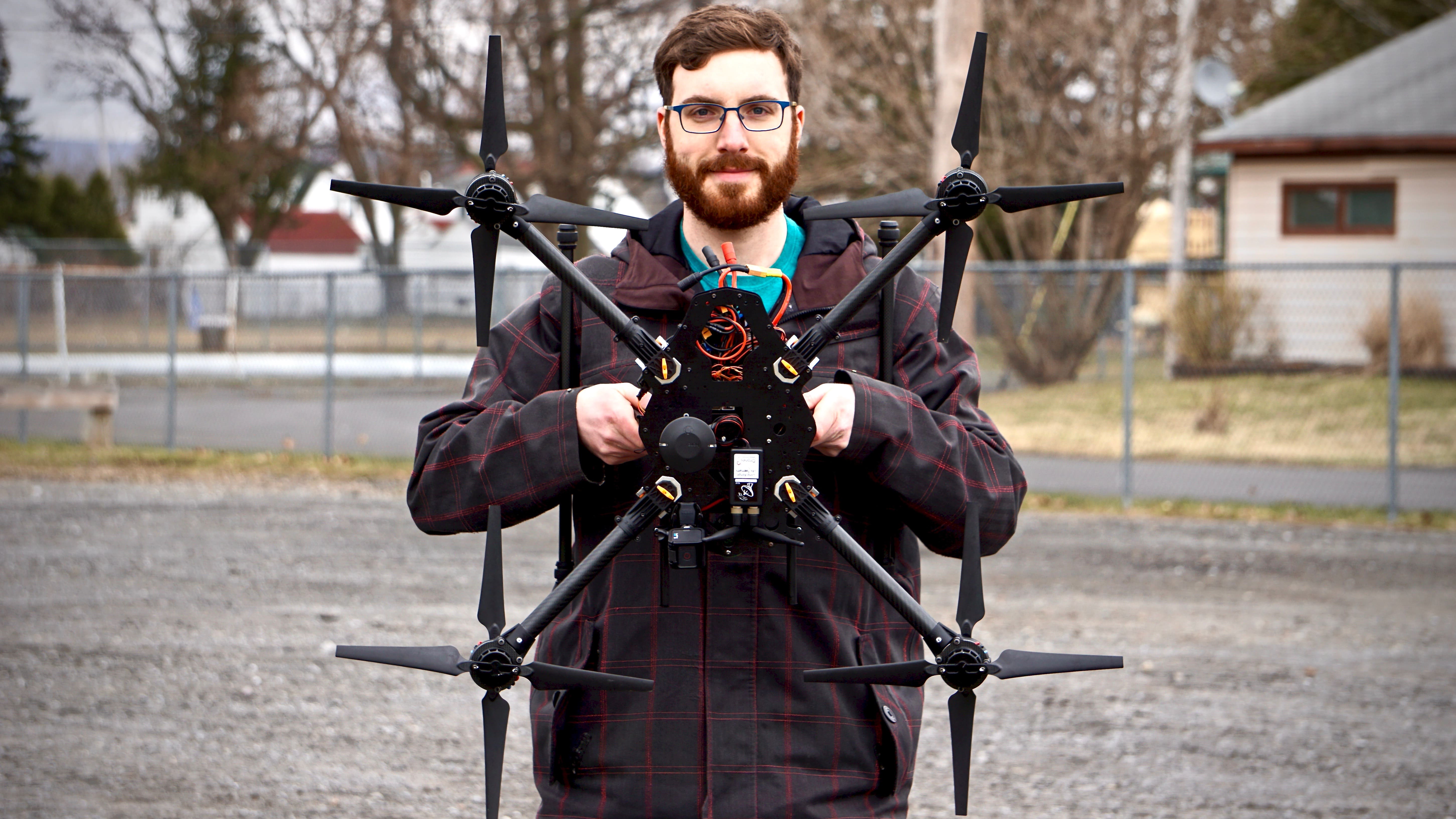
Building my Fleet
The carbon fiber racers and heavy lift aerial photography rigs I’m designing and building today are a far cry from my first hobbyist tricopter made of wood and hot glue. The quality of my components has taken a quantum leap since I started, as has my skillset and knowledge base, but my fascination with this rapidly developing field keeps me striving to learn more.
To view build albums and test videos visit the project!
Project: Drone Building
Skills: Programing / Piloting / Electronics
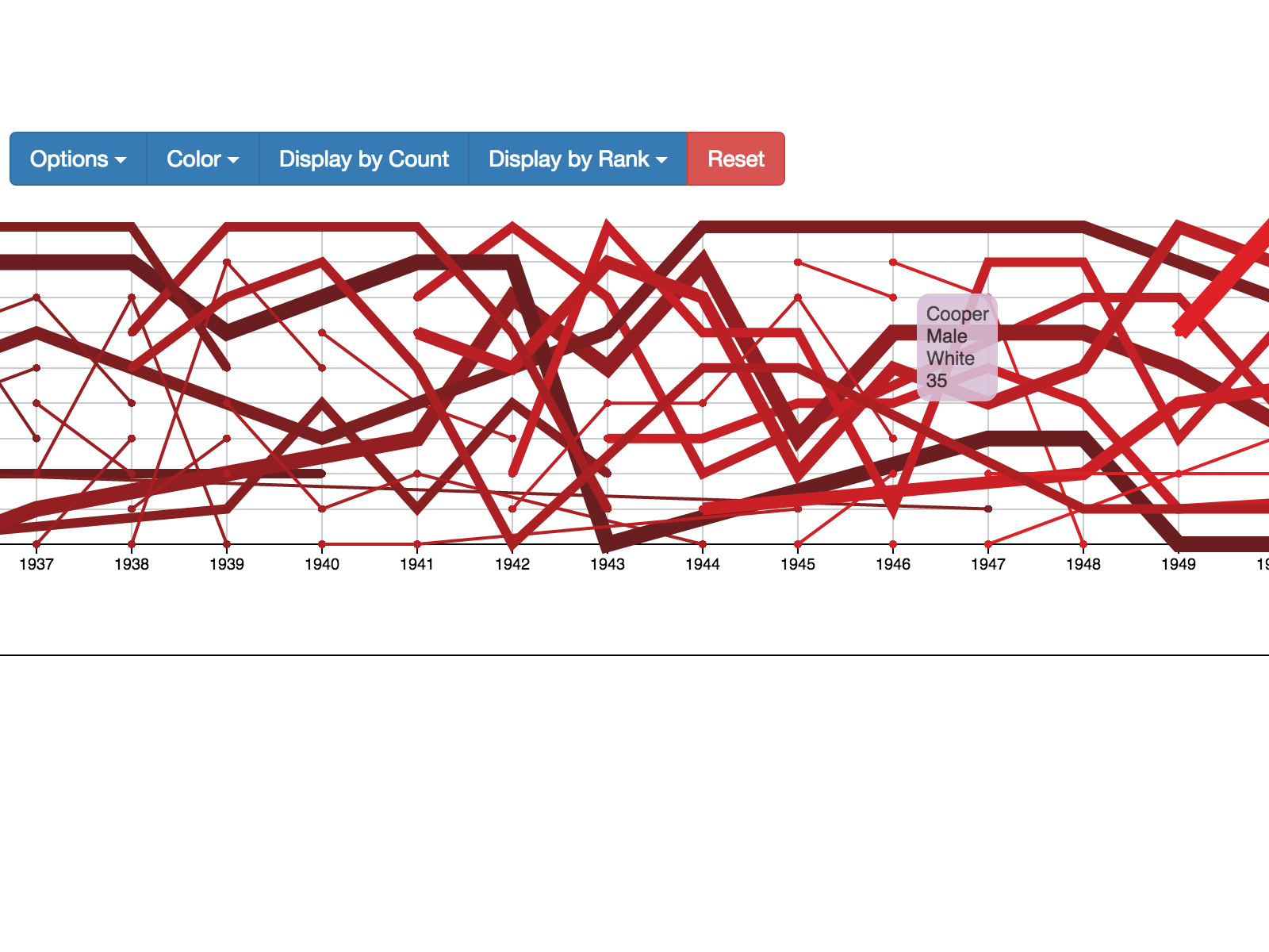
Ranked Timeline Research
I worked with the head of the Computer Science department at Wheaton College, Michael Gousie, to create the Ranking Timeline, a visualization of ranked, time-series data using HTML5, Javascript display and D3js.
A comprehensive overview of the project and version information can be found on the project page
Project: Summer CS ResearchSkills: HTMl5 / Javascript / d3js
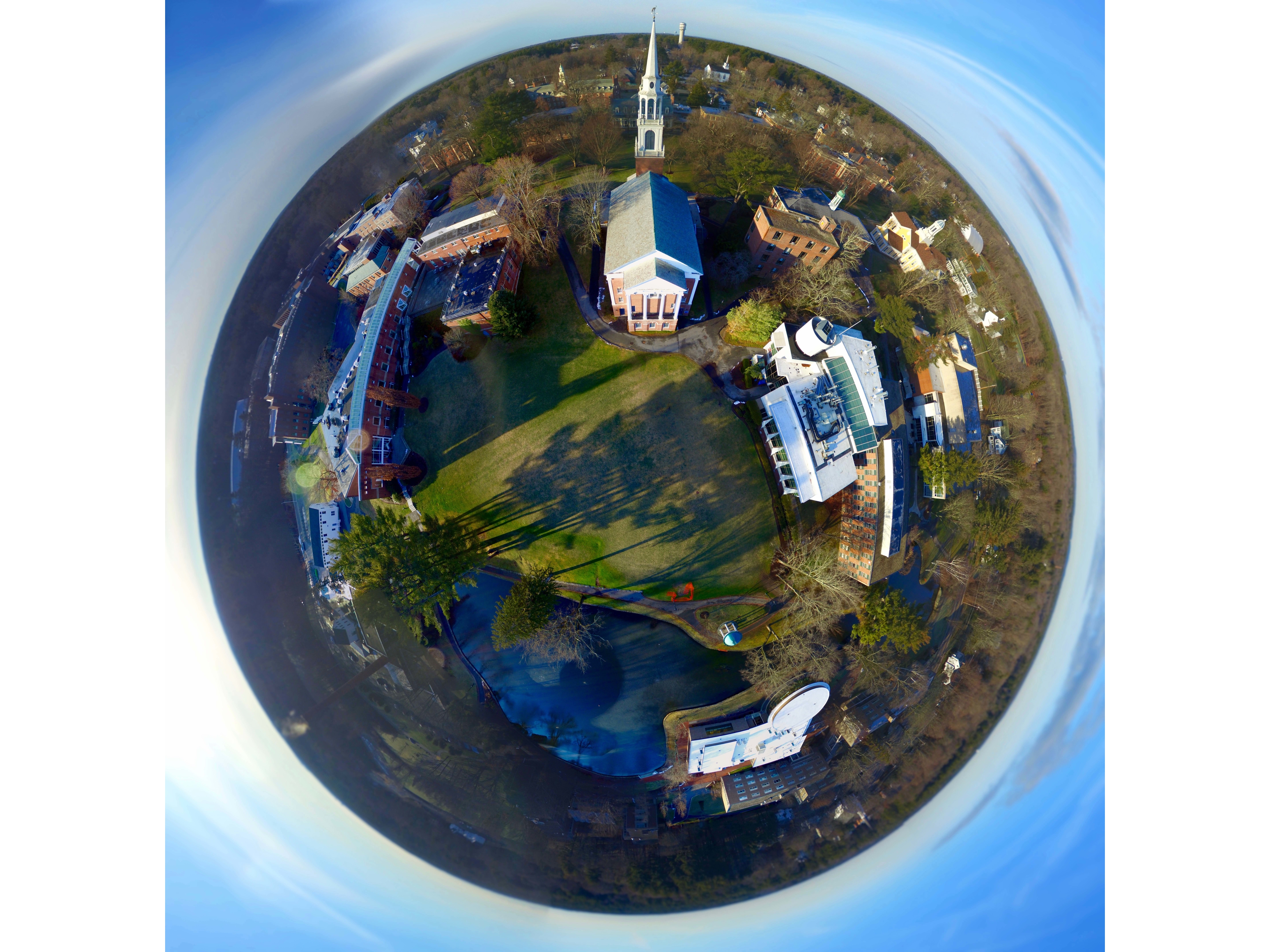
Aerial Mapping and Video
The expansive view from an aerial craft has always attracted me. Multirotors make this formerly prohibitive vantage point readily accessible.
Aerial photos can be combined into panoramas and stitched into robust stereographic visualizations. The high resolution panoramas, composed of a minimum of 18 still photos, produce a single image capable of being exported as anything from a horizontal infinitely panning spherical image to a transverse Mercator visualization.
My Aerial Videos and projects can be viewed on my YouTube account.
Project: Aerial Cinematography and Modeling
Skills: Piloting / Programming / Editing
- all
- design
- HTML5
Building Multirotors
Design / Programing
Web Research
Javascript / HTML5